|
||
|
Brian's "Picture of the Week" |
||
|
IMAGE: Hurricane Ophelia 2005 |
||
|
|
BrianWhittaker.com |
||||
|
|
||||
|
||
|
Brian's "Picture of the Week" |
||
|
IMAGE: Hurricane Ophelia 2005 |
||
|
|
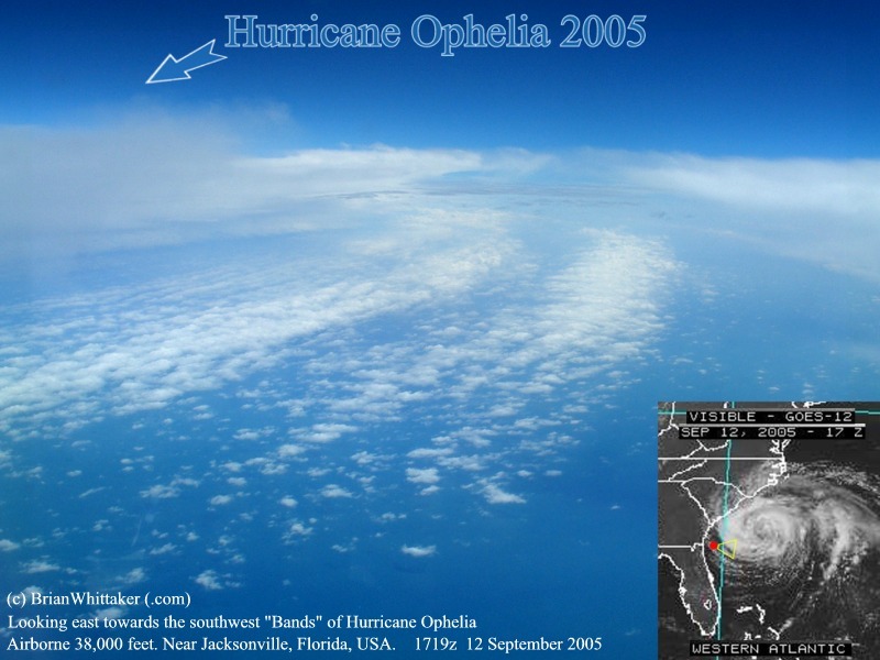
To my surprise, there was a clearing in the cloud which allowed us to see towards Hurricane Ophelia to the east! We were, in fact, between some of the storm's curving "bands" while airborne at 38,000 feet. The air here was rather still, testimony to Ophelia's stationary movement. However, below, the choppy seas indicated that something was indeed different than usual about today's weather off Jacksonville, Florida. Inset satellite image shows the actual position and cloud clearing where the photo was taken. [Note: Just like with Temperate winter Frontal storms, being near dramatic features of cloud on satellite images is irrelevant. Here the winds were calm and under 10 miles per hour with no convective activity present.] 1719z 12 September 2005. [800x600] Photo: (c)
2005 Brian Whittaker (.com) |